


DAVENPORT PCT 13, Scott County, Iowa
About
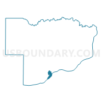
Outline

Summary
| Unique Area Identifier | 583412 |
| Name | DAVENPORT PCT 13 |
| County | Scott County |
| State | Iowa |
| Area (square miles) | 2.07 |
| Land Area (square miles) | 1.44 |
| Water Area (square miles) | 0.63 |
| % of Land Area | 69.56 |
| % of Water Area | 30.44 |
| Latitude of the Internal Point | 41.51016380 |
| Longtitude of the Internal Point | -90.60834500 |
Maps


Graphs
Select a template below for downloading or customizing gragh for DAVENPORT PCT 13, Scott County, Iowa


Neighbors
Neighoring Voting District (by Name) Neighboring Voting District on the Map
- BLACKHAWK 1 Voting District, Rock Island County, IL
- DAVENPORT PCT 11 W/BLUE GRASS TWP PART, Scott County, IA
- DAVENPORT PCT 12, Scott County, IA
- DAVENPORT PCT 14, Scott County, IA
- DAVENPORT PCT 31, Scott County, IA
- ROCK ISLAND 1-1 Voting District, Rock Island County, IL
- SOUTH ROCK ISLAND 1 Voting District, Rock Island County, IL
Top 10 Neighboring County Subdivision (by Population) Neighboring County Subdivision on the Map
- Davenport city, Scott County, IA (99,685)
- South Rock Island township, Rock Island County, IL (18,407)
- Rock Island township, Rock Island County, IL (17,776)
- Blackhawk township, Rock Island County, IL (10,019)
Top 10 Neighboring Place (by Population) Neighboring Place on the Map
Top 10 Neighboring Unified School District (by Population) Neighboring Unified School District on the Map
Top 10 Neighboring State Legislative District Lower Chamber (by Population) Neighboring State Legislative District Lower Chamber on the Map
- State House District 72, IL (101,862)
- State House District 84, IA (31,647)
- State House District 86, IA (28,323)
Top 10 Neighboring State Legislative District Upper Chamber (by Population) Neighboring State Legislative District Upper Chamber on the Map
- State Senate District 36, IL (206,729)
- State Senate District 42, IA (62,375)
- State Senate District 43, IA (59,021)
Top 10 Neighboring 111th Congressional District (by Population) Neighboring 111th Congressional District on the Map
Top 10 Neighboring Census Tract (by Population) Neighboring Census Tract on the Map
- Census Tract 241.02, Rock Island County, IL (5,350)
- Census Tract 125.02, Scott County, IA (3,947)
- Census Tract 110, Scott County, IA (2,725)
- Census Tract 237, Rock Island County, IL (2,494)
- Census Tract 226, Rock Island County, IL (2,311)
- Census Tract 122, Scott County, IA (2,210)
- Census Tract 244, Rock Island County, IL (1,943)
- Census Tract 123, Scott County, IA (1,652)
- Census Tract 124, Scott County, IA (1,375)